Choosing the Best 3D Scanning Vancouver Services: Leica vs. FARO vs. SLAM Technology
The architecture, engineering, and construction (AEC) sectors in Vancouver, BC increasingly rely on advanced reality capture technologies to ensure precision and streamline workflows. Modern 3D laser scanning has become a standard practice…
The architecture, engineering, and construction (AEC) sectors in Vancouver, BC increasingly rely on advanced reality capture technologies to ensure precision and streamline workflows. Modern 3D laser scanning has become a standard practice for capturing accurate, efficient spatial data of physical environments.
Whether you are a property owner planning a detailed home renovation in Greater Vancouver, a real estate professional requiring accurate documentation, or a contractor managing a complex commercial build, selecting the right 3D scanning Vancouver services is critical. This decision goes beyond hiring a service provider – it requires matching your project's accuracy requirements (millimeter vs. centimeter tolerance) with the appropriate technology, including Terrestrial Laser Scanners (TLS) from manufacturers such as Leica and FARO, or mobile SLAM (Simultaneous Localization and Mapping) systems.
The Essential Role of 3D Scanning in Vancouver's AEC Industry
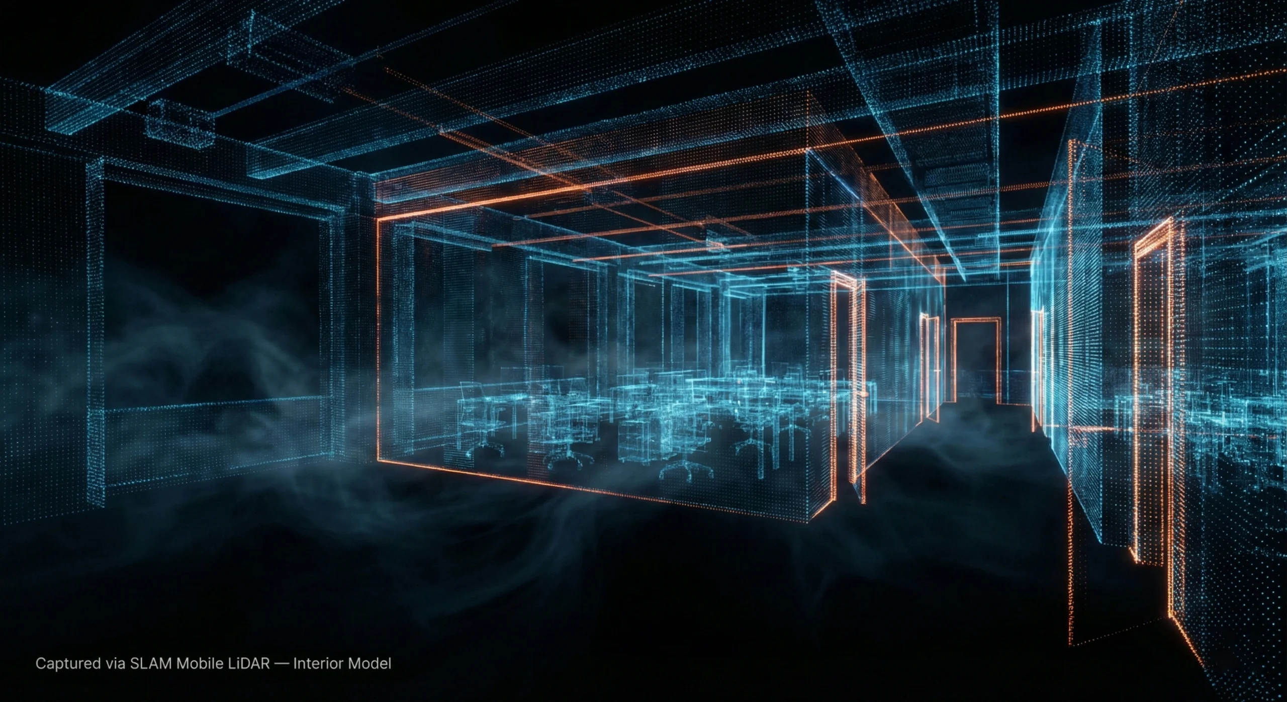
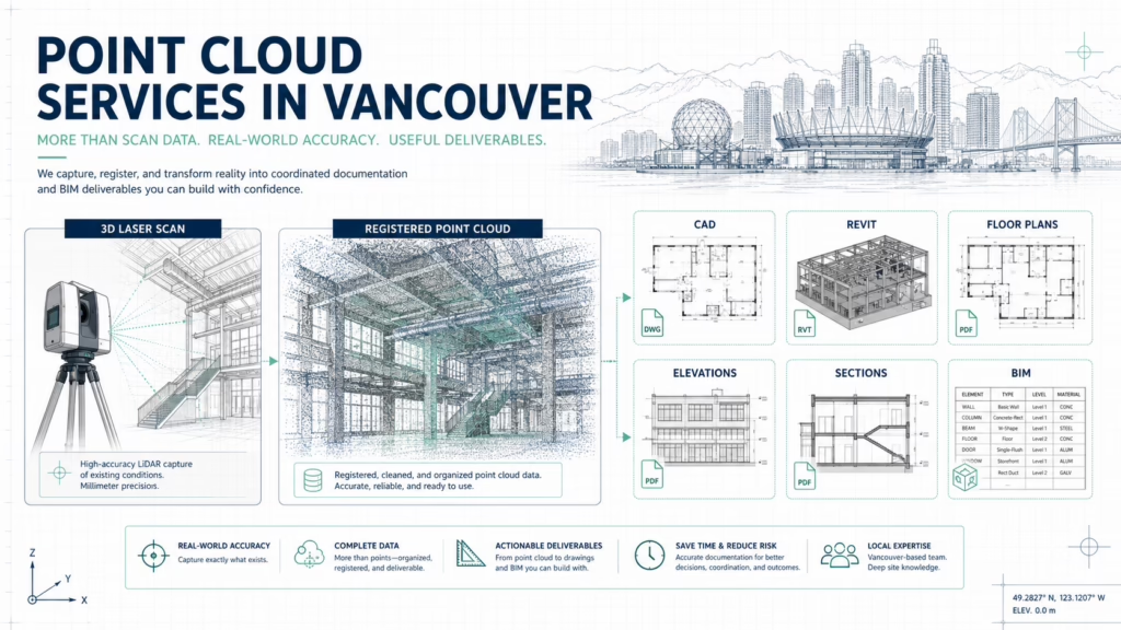
3D scanning is no longer a luxury; it is an essential tool for high-quality project delivery and risk mitigation. Using LiDAR technology, scanners capture millions of spatial data points to create a highly accurate point cloud – a precise digital representation of existing conditions.
These point clouds form the foundation for:
- Accurate floor plans
- Reliable as-built drawings
- BIM models for design coordination
Across Vancouver's construction industry, 3D scanning improves accuracy, enhances collaboration, and reduces costly rework.
High-density 3D point cloud visualization of a building’s interior captured via mobile LiDAR scanning
Precision as the Foundation for Building Permit Drawings
For projects governed by strict provincial and municipal standards, accuracy is non-negotiable. High-quality 3D scanning significantly reduces human measurement error and supports smoother permitting and construction workflows.
Millimeter-level accuracy is critical when preparing building permit drawings, verifying as-built conditions against design intent, coordinating structural elements, and supporting sustainable construction strategies. Reliable scan data ensures that submitted documentation accurately reflects existing site conditions – an essential requirement for regulatory compliance.
Streamlining Renovation Planning and Contractor Estimates
3D scanning simplifies complex workflows for both residential and commercial projects throughout Greater Vancouver.
For homeowners and developers, scans create a precise digital twin of the space, fully compatible with as-built documentation. Interior designers rely on this data as advanced interior design tools, ensuring that millwork, cabinetry, and layouts fit precisely without costly field adjustments.
Contractors benefit from a highly detailed digital baseline that enables them to:
- Produce accurate contractor estimates using reliable quantity take-offs
- Improve coordination by identifying clashes between structural, mechanical, and plumbing systems before construction
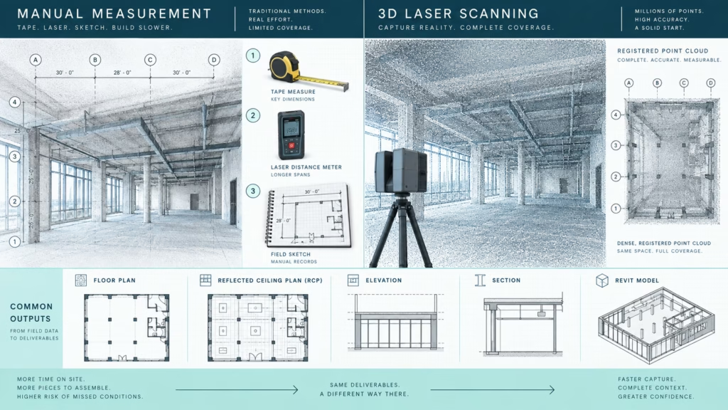
- Increase speed by capturing millions of data points in minutes rather than hours
Understanding the Core Technologies: TLS vs. SLAM
When selecting 3D laser scanning services in Vancouver, professionals must understand the two primary capture methodologies: Terrestrial Laser Scanning (TLS) and SLAM-based mobile scanning. The choice represents a fundamental trade-off between maximum accuracy and maximum speed.
Fixed-Point Terrestrial Scanners (TLS): The Accuracy Benchmark
TLS systems are mounted on a tripod and remain stationary during capture. They measure distance by calculating the time it takes for a laser beam to return to the scanner, delivering millimeter-level accuracy.
TLS is the preferred solution when:
- Millimeter accuracy is required (industrial plants, structural analysis)
- High point cloud density is necessary to capture fine surface detail
- Controlled environments allow for multiple scan setups
SLAM Scanners: Prioritizing Speed and Mobility
SLAM technology emphasizes speed, flexibility, and mobility. Operators can walk continuously through a space using handheld, wearable, or backpack-mounted LiDAR systems.
Key characteristics include:
- 1. Real-time mapping using LiDAR sensors and inertial measurement units (IMUs)
- 2. Rapid data acquisition, often 5 – 10 times faster than tripod-based scanning
- 3. Operational flexibility in complex, multi-level, or GPS-denied environments
The Critical Trade-Off: Speed vs. Accuracy
TLS (Leica / FARO):
- Accuracy: 1 – 2 mm
- Capture Method: Stationary, multiple setups
- Field Time: Longer
- Drift Risk: Minimal
SLAM (BLK2GO / VLX):
- Accuracy: 5 mm to 3 cm
- Capture Method: Continuous mobile scanning
- Field Time: 5 – 10× faster
- Drift Risk: Possible over long distances
For structural verification and tolerance-sensitive applications, TLS remains the gold standard. For large-scale coverage and rapid as-built documentation, SLAM provides substantial efficiency gains. High-end systems such as the NavVis VLX 3 can achieve accuracies of 5 mm or better when tied to survey control.
Side-by-side comparison of Leica and FARO 3D scanners on a Vancouver construction site, highlighting
Leica vs. FARO: Terrestrial Scanning Leaders
Leica Geosystems: Precision and Performance
Leica is widely recognized for survey-grade accuracy. The Leica RTC360 is a flagship TLS scanner known for speed and data quality.
- Accuracy: ~2 mm at 10 m
- Speed: Fast colorized scans using Visual Inertial System (VIS)
- Data Quality: Dense, low-noise point clouds with high-quality HDR imagery
FARO Technologies: Versatility and Value
FARO scanners balance performance and cost, making them popular across a wide range of projects.
- Accuracy: Within a few millimeters
- Range: Up to 350 m (Focus Premium)
- Software: Strong CAD and BIM integration via FARO Scene
Portable TLS: Leica BLK360 G2
Compact TLS units like the Leica BLK360 G2 bridge the gap between mobility and accuracy.
- Lightweight and portable (≈850 g)
- Rapid 360° scans (~20 seconds)
- Ideal for interiors, real estate floor plans, and fast site documentation
Professional using Leica RTC360 scanner on a commercial site in Vancouver to capture high-accuracy p
The Rise of SLAM for Home Renovation Projects in Greater Vancouver
Mobile SLAM scanning represents a paradigm shift in efficiency. By capturing data while walking through a space, field time is dramatically reduced – making SLAM ideal for large residential renovations and interior-heavy projects.
Leading SLAM Systems
- Leica BLK2GO: Handheld, fast capture, lower point density
- NavVis VLX 3: Wearable system delivering up to 1.28 million points per second with survey-grade accuracy
- FARO Orbis: Hybrid solution combining mobile SLAM with stationary flash scans
SLAM handheld scanner being used to map the interior of a residential property in Vancouver for fast
Practical Applications: Matching Technology to Project Needs
High-Accuracy Projects
- Structural quality control
- Heritage documentation
- Detailed MEP and industrial scanning
Speed-Focused Projects
- Real estate floor plans
- Preliminary renovation layouts
- Facility management and large interiors
Hybrid Workflows: Best of Both Worlds
Experienced 3D scanning Vancouver service providers often combine technologies:
- TLS scans anchor critical geometry
- SLAM captures large areas quickly
- Integrated datasets deliver both accuracy and efficiency
Selecting the Right 3D Scanning Vancouver Services Partner
Technology alone is not enough – operator expertise is equally critical. A qualified provider brings:
- AEC experience and local knowledge
- Clear understanding of accuracy requirements
- Deliverables optimized for CAD, BIM, and permit submissions
Conclusion
Choosing the right 3D scanning solution in Vancouver depends on balancing accuracy, speed, and cost. Leica and FARO TLS systems deliver industry-leading precision, while SLAM technology offers unmatched efficiency. The most effective outcomes are achieved through hybrid workflows, guided by experienced professionals who understand how to align technology with project goals.

Analyse this page with AI
Want a summary, fact-check, or an RFP template built around these measurement standards? Send this page directly to your favourite AI model.
Content and prompt will be copied to clipboard for some models.