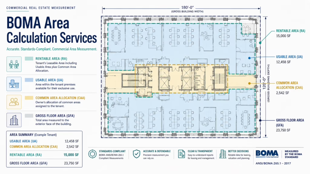
Accurate BOMA Area Calculations & Measurement Services
BOMA area calculations for commercial leasing, property management, lease plans, rentable area, usable area, GFA, and clear reporting.
Learn More arrow_forwardCapture accurate existing conditions with high-density LiDAR scanning for residential, commercial, and industrial projects.
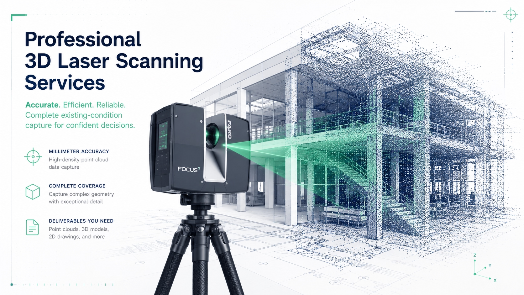
Professional laser scanning provides a fast, accurate, and non-invasive way to document buildings and structures. Using advanced LiDAR technology, we capture millions of measurement points to create a precise digital representation of your property.
Traditional measurements can be time-consuming and may overlook important details. Laser scanning captures the entire building in a single visit, recording walls, ceilings, floors, structural elements, building services, and architectural features with exceptional accuracy.
The result is a complete digital record that can be used for renovation planning, design, engineering, facility management, and future modifications.
Our laser scanning services support projects of every size — from private homes to complex industrial facilities.
Accurate existing-condition capture for homes, multifamily buildings, and renovation planning.
Verified building data for fit-outs, tenant improvements, redesigns, and documentation.
Efficient documentation for large, occupied, and complex operational environments.
Detailed scan data for public, specialty, and facility-related documentation needs.
Our scans record visible architectural and building elements, creating a reliable digital record of the existing property.
Laser scanning is only the first step. We transform scan data into practical deliverables tailored to your project — from CAD drawings and Revit models to registered point cloud files.
Your final package is organized, reviewed, and delivered in the formats your architects, engineers, contractors, and project team can use immediately.
We use professional handheld and terrestrial laser scanning equipment to capture millions of measurement points with exceptional accuracy.
Integrated colour cameras produce realistic colour point clouds, making documentation easier to understand and verify.
We review your project requirements, discuss deliverables, and provide a fixed quotation.
Our technicians capture the property using professional LiDAR equipment, recording millions of accurate measurement points.
Scan data is registered, colourized, and quality checked to produce an accurate digital model of the existing building.
Depending on your project requirements, we prepare CAD drawings, Revit models, or deliver the registered point cloud.
All files are reviewed for quality and delivered in the requested formats within the agreed timeline.
Our multidisciplinary team combines engineering, architecture, laser scanning, BIM modeling, and CAD drafting to provide dependable existing-condition documentation.
Our laser scanning services support professionals who rely on accurate existing-condition data for planning, design, coordination, and delivery.
We provide laser scanning and documentation services across British Columbia — from Greater Vancouver to Vancouver Island and beyond.
Whether you’re planning a renovation, documenting an existing building, or starting a large commercial project, our laser scanning services provide the accurate information your team can build from.
More Services
Browse related service offerings built with the same precision-first approach.
BOMA area calculations for commercial leasing, property management, lease plans, rentable area, usable area, GFA, and clear reporting.
Learn More arrow_forward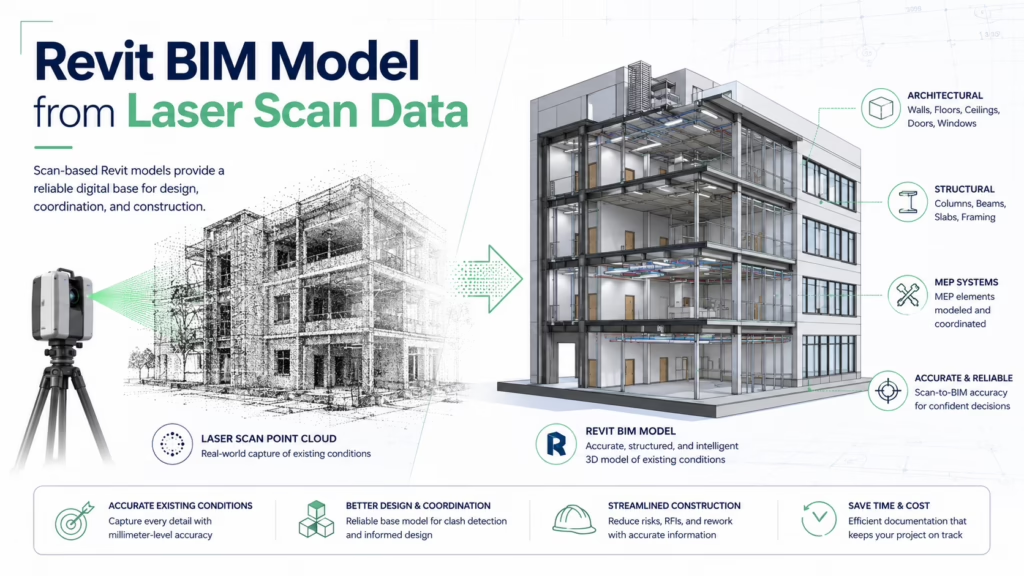
Revit & BIM modeling from point cloud data with scan-to-BIM, LOD 100–300, RVT models, CAD exports, and PDF drawings.
Learn More arrow_forward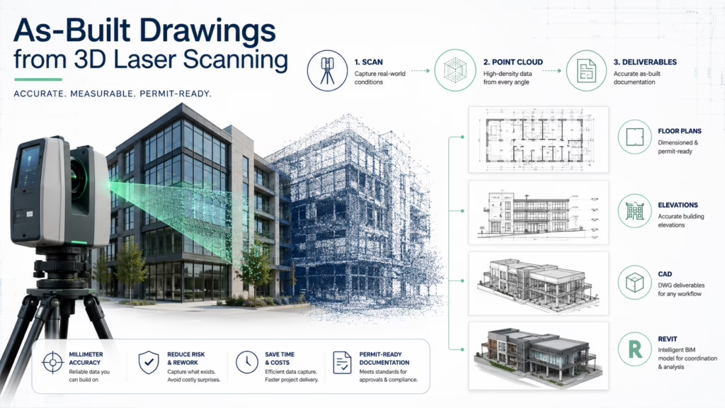
As-built drawings from 3D laser scanning, including floor plans, elevations, sections, CAD, Revit, PDFs, and permit-ready drawing sets.
Learn More arrow_forward